

Central America Premium Analysis
The Bottom Line
- Swell Trend: Good shot of SSW swell peaks Tue, holds into mid week
- Watch Out For: Early afternoon high tide slows surf down at most spots
- Other Tidbits: SPAC staying active, possible tropical swell activity in the longer range
Tuesday, May 25th: 4-5’+ waves off SSW swell. Fun run of SSW swell tops out, putting lots of exposed spots in shoulder high to head high+ surf, while top breaks see better sets. Early afternoon high tide will be bogging many breaks down.
Wednesday, May 26th: 4-5’+ surf from SSW swell. Holding SSW swell maintains shoulder high to head high+ waves at good exposures and slightly overhead sets at better breaks. Deep high tide in the early afternoon slows the surf at most spots.
Winds/weather: Diurnal wind pattern prevails.
Costa Rica: Light/variable to light offshore morning winds for most areas, while northernmost spots see more moderate AM offshore flow. Light+ to locally moderate onshore flow for the afternoons.
Long Term Forecast Analysis (Thursday, May 27th and Beyond)
SPAC Overview:
Surf slowly eases going into the back half of the week, as old SSW swell fades and a fresh round of SW swell begins to join in. The swell mix has most exposed spots in waist to head high waves on Thursday. Friday’s surf is up a notch, as the SW swell tops out. Holding SW swell keeps many exposures in chest-shoulder-head high zone waves on Saturday, then a reinforcing SSW swell nudges surf up by the end of the weekend.
Stronger, longer-period SW swell is due to move in for the beginning of next week, rise through Tuesday, then peak on Wednesday/Thursday, 2nd-3rd, with head high+ to several feet overhead waves at good exposures. That surf gradually tapers off into the following weekend.
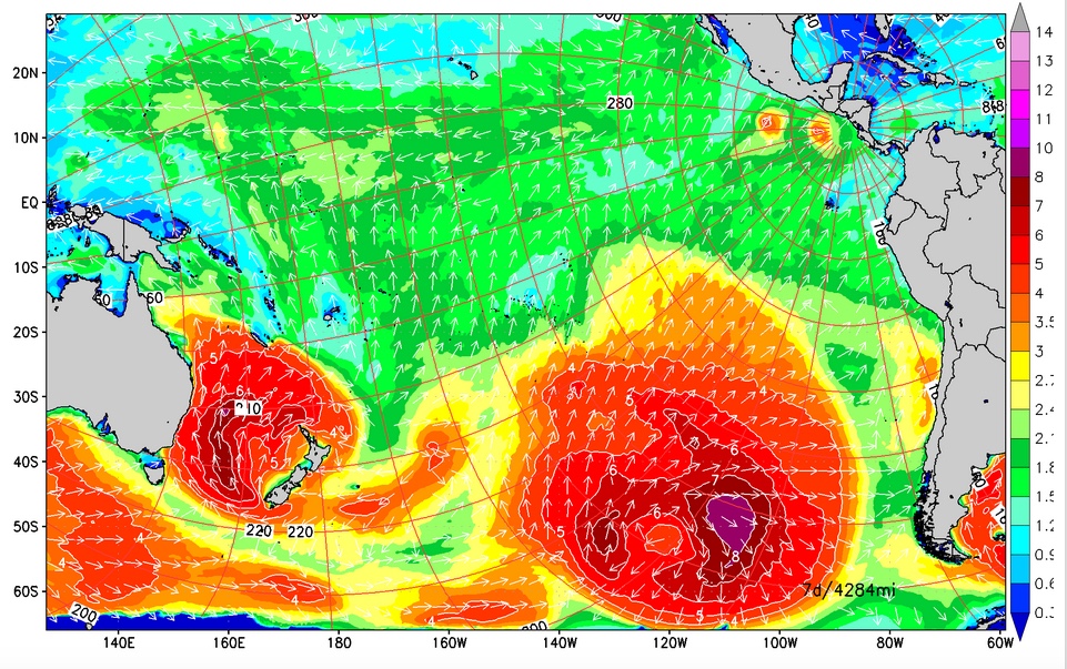
Forecast chart showing solid Southern Hemi developing in the SPAC and some swell forming in the tropics.
Tropics: There is nothing brewing right now, but long range progs are calling for a system to rapidly develop off Southern Mexico this weekend, 29th-30th. Under that scenario, there could be some tropical swell in the mix during the last few days of this month. Stay tuned for updates on this potential storm/swell system.
Get your boards ready. Do a gear check.
No comments:
Post a Comment