Another day in the warm water surf :) Surf was easily 6 feet with plus sets. The guys were mostly focused at Northside Rock and I opted for the Northside Rock North where many waves came through, slightly bigger with steep take-offs. The Northside Rock had more waves but a bit more confused wave action going on with the first line/second line interface. I had some funny things happen over there like then the wave jettisoned the board from underneath me leaving me looking at my board in front of me. LOL. Another one the wave humped me, throwing the board and I upwards for another separation. We were out in the water for 3 hours today, an hour more than each of the previous two days. For me, the rides were not as frequent and the paddling back out was shorter as the wave disappears when it hits deep water in contrast the shallows on waves from The Wash.
Post Surf Grinds: I prepared bacon, fried eggs with a slice of cheese on top.


Central America Premium Analysis
The Bottom Line
- Swell Trend: Solid SSW swell peaks mid week, stronger SSW swell for the back half of the week
- Watch Out For: Mid AM high tide slows surf down some
- Other Tidbits: SPAC stays active in the long range
Tuesday, April 20th: 4-6′+ surf from SSW swell mix. Mid-period SSW swell continues as fresh, long-period SSW swell fills in. Lots of good exposures see consistent shoulder high to a foot+ overhead waves, while standouts do better on sets, showing strongest in the afternoon/evening. Mind the mid morning high tide, which tends to slow down/fatten up the surf at most breaks.
Wednesday, April 21st: 5-7′+ waves off peaking SSW swell. Long-period SSW swell tops out, putting most exposures in consistent surf running head high to 1-2′ overhead, as best breaks are consistently hitting overhead. Mid morning high tide bogs most spots down some.
Winds/weather: Diurnal wind pattern prevails.
El Salvador: Light/variable to light offshore flow early mornings, followed by mainly moderate southerly shifting WSW-W flow for the afternoons. The onshores look to ease Wednesday evening.
Nicaragua: Light+ to moderate offshore flow in the morning Tuesday, strongest for southernmost Nica, will be followed by an afternoon sea breeze, strongest for northern Nica. Southernmost areas due to see offshore flow all day on Wednesday, while other regions see lighter offshores in the morning, turning to a moderate afternoon sea breeze.
Costa Rica: Light offshore mornings, followed by light+/locally moderate afternoon onshores.
Long Term Forecast Analysis (Thursday, April 22nd and Beyond)
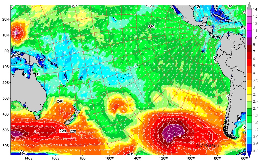
SPAC Overview:
There’s been a steady stream of strong storms moving out from under New Zealand, tracking across the central SPAC and then settling into the east end of the ocean off South America this month. Those lows have set up the good run of Southern Hemi swell which has been rolling in lately and will continue to move in through this week and beyond.
Stronger SSW swell for the back half of this week.
Solid SSW swell which was cranked out by a storm with satellite confirmed winds in the 50-60kt range and seas to 45’+ will continue going into the back half of the week, as a stronger, longer-period SSW swell whipped up by a low with satellite measured seas hitting 50′ steady rises. That Southern Hemi combo has lots of exposed spots in solidly overhead surf on Thursday, then overhead to double overhead waves on Friday/Saturday morning when the swell maxes out. Size eases by the end of the weekend, but there will still be plenty of overhead waves on Sunday.
The trend towards fading surf continues through the first part of
next week, as old SSW swell winds down and a new, more moderate scale SW
swell joins in. The next run of strong, back-to-back SSW Southern Hemis
is scheduled to be filling in by the back half of the upcoming week,
then peak by the end of this month and the start of May, 30th-2nd, with
the possible return of overhead-double overhead zone waves at good
exposures. We’ll keep you posted on the progress of those storm/swell
systems as they develop.
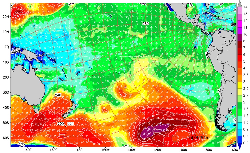
Long range progs show more Southern Hemi setting up for the end of this month/start of May.
No comments:
Post a Comment